By Steve Hall
As my birthday approached I was planning another long celebration day out. Poucher's 'The Peak and Pennines' has this to say about Bleaklow: "this sinister mountain should never be explored by the lone climber, even in clear weather". This was clearly a sign, so I decided on a solo unsupported outing on the Derwent Watershed.
Alarm went at 2.00 am, and eating a huge bowl of porridge at that hour was hard work. At 2.30 I was on the road and at 3.30 paying the machine in Hope car park by head torch. Set off into the darkness at 3.45, chilly so some extra layers on. The difficulty of going unsupported is carrying enough water, I had 2 litres plus a spare bottle, along with food & spare gear this made for quite a heavy sack: but in reality 2 litres wasn't going to be enough if it was hot later. I've never been keen on stashing drinks to collect on route, it makes a long distance seem artificial if you've already driven half way round it, and what if you get there and your stash has been devoured by badgers? So be self -sufficient.
The ascent of Lose Hill is simple enough in the dark, the dawn chorus was in full swing as it gradually got light. Along the ridge it was quite misty, passed a couple of ponies (odd - are they ever there in daylight?) then the sun broke through after Mam Tor. Dropping down from Brown Knoll I met another runner going in the opposite direction, with head torch and large sac, the only other person I saw on the tops all day. Round Kinder Edge the cloud thinned and I had superb views out to the west, with brilliant clear sunlight and the shadow of Kinder in the foreground.

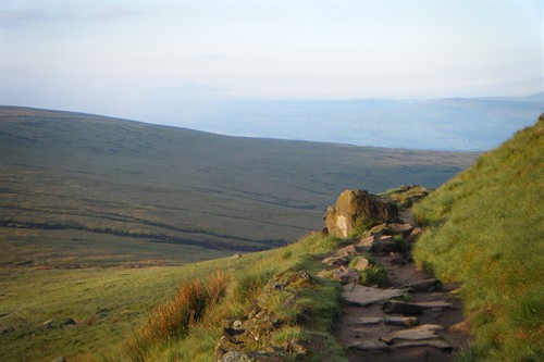
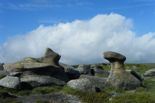
Across Snake Summit about 7.30 and along the well engineered Pennine Way up to Wain Stones. Hern clough is about the only surface drainage you pass on the true watershed, you could get a drink there but after the night's rainfall it was dark and peaty. Crossing the top of Bleaklow is always interesting, but I hadn't expected the weird impact of the huge effort that has been put into arresting erosion on all 3 moorland areas. This looks to have been a great success with Bleaklow now green and verdant, not black and oozing - great - but it seems to make it even more confusing. The ancient boundary stakes that just about mark the 'shed route are hard to locate, there are no tracks to see, and a bearing is always hard to follow in the maze of groughs. Still, I made good progress to Bleaklow Stones then made a mess of finding the route down to Swains Head. This fascinating place, a key target on the Masters Hike of old, is so indistinct it's not really a place at all.
Thankfully the bogs were dry, although there were occasional unexpected deep bits. This section round to Cut Gate is the crux, keeping up any rhythm is hard and it seems to go on & on. Margery Hill refused to get any nearer although the miles crept by, then I realised it wasn't even Margery Hill but Outer Edge, and I had even further to go. Here the views North and East are excellent, over West Yorkshire, Emley Moor and the Holme Valley. This is also the watershed of England - a drop of rain to the Left would find its way to Longdendale, the river Etherow and eventually the Irish sea, to the Right would descend to the Derwent and out to the North Sea. Along here I allowed frustration at my pace to get in the way of enjoying the day. This stretch typifies the route - a sense of real wilderness and isolation, but with fine views; however I was distracted by pushing the pace.
Now the sun was out and it was heating up fast, a lot hotter than forecast. I had brought a small canister of sun block and applied it liberally, if I ran out I would have to coat myself with peat. I was now getting through water fast and used a Dioralite sachet to replace some salts.

Finally I crossed the venerable Cut Gate track and with Margery Hill behind me the end was in sight. Rather than stick to the true Watershed round the headwaters of Abbey Brook I dropped down into the valley and restocked my water at Fairholmes, which was heaving, in sharp contrast to the empty moors above. By now legs were protesting and it felt like hard work.
My aim was to do 40 miles, and I was going to hit that bang on if I went directly down to Yorkshire Bridge and cut out High Neb. Need to save something for next time! The final climb up onto Win Hill was actually a relief, having done a lot of miles with undulations but no steep climbs. At the top I stopped the timer and sat down to enjoy the view - the Northern horizon looks suitably impressive especially when you've just been there. The steep descent past Twitchel Farm was a killer ending, starting at Hope adds a few miles but book ending the day with Lose and Win Hill seems the right way to do it. Eventually back to the car in 10.23 and 39.8 miles, near enough. Next time I'll choose a cooler day…
